
Between 1956 and 1985, the National Interstate and Defense Highway Act of 1956 saw the construction of 41,000 miles of limited-access roadway. Under the traditional Cartesian planning tools, these highways appear as scars across the landscape, fragmenting the underlying community fabric.
Beneath challenges the omniscient, panoptic tradition of cartography and planning. By hijacking modern tools of mapping and urban planning, Beneath transforms the liminal spaces beneath our vast transportation infrastructure, revealing a hidden underground. Masked from the searching eyes of aerial imagery and freed from the constraints of materiality, context, and hard edges, this new world is ripe with opportunity - for those already inhabiting and for those who simply want to...disappear.
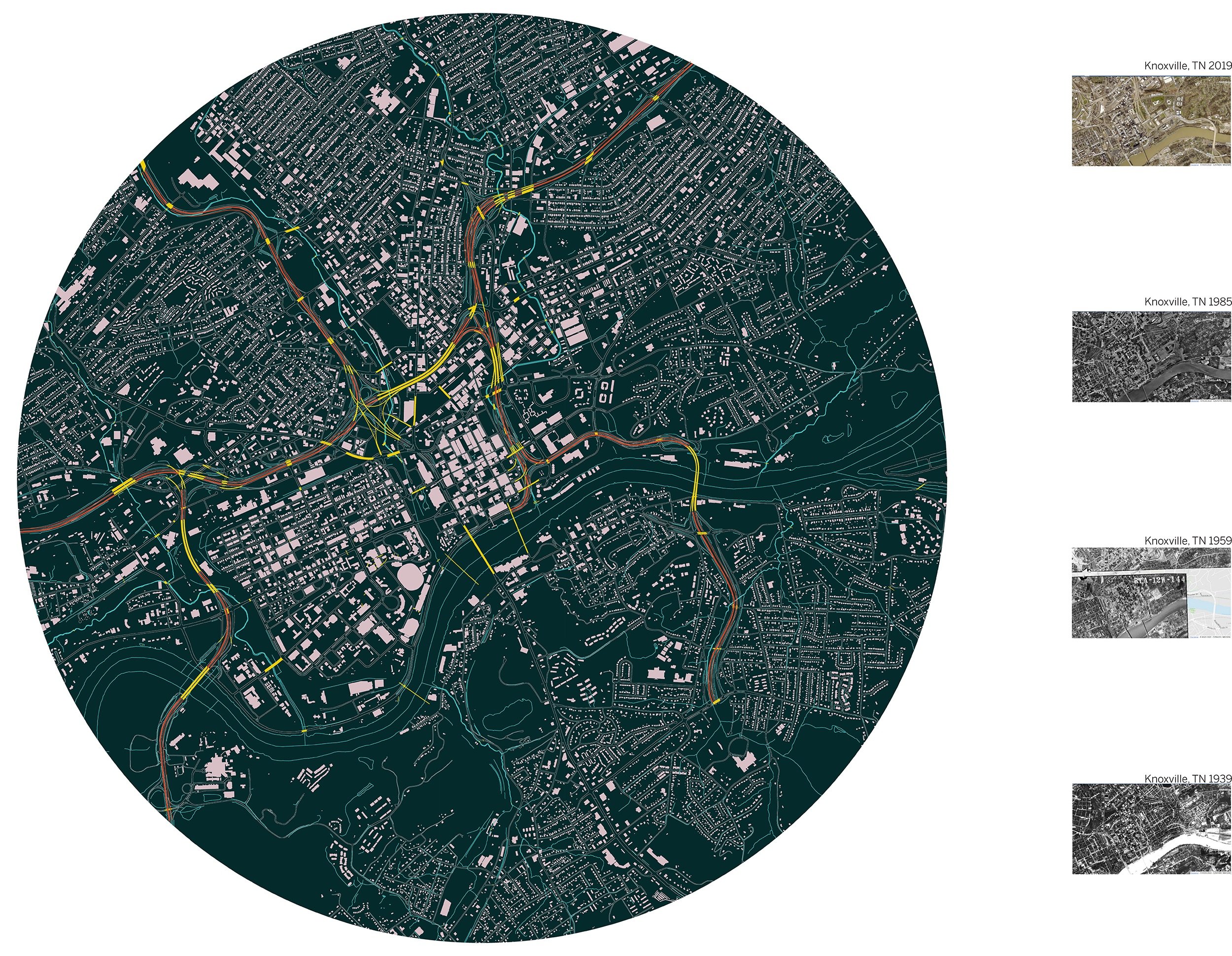
This map highlights the extensive transit infrastructure within just a 2.5 mile radius of downtown. When compared to aerial photography since 1935, the rapid increase in interstate surface (highlighted in yellow) is striking indeed.
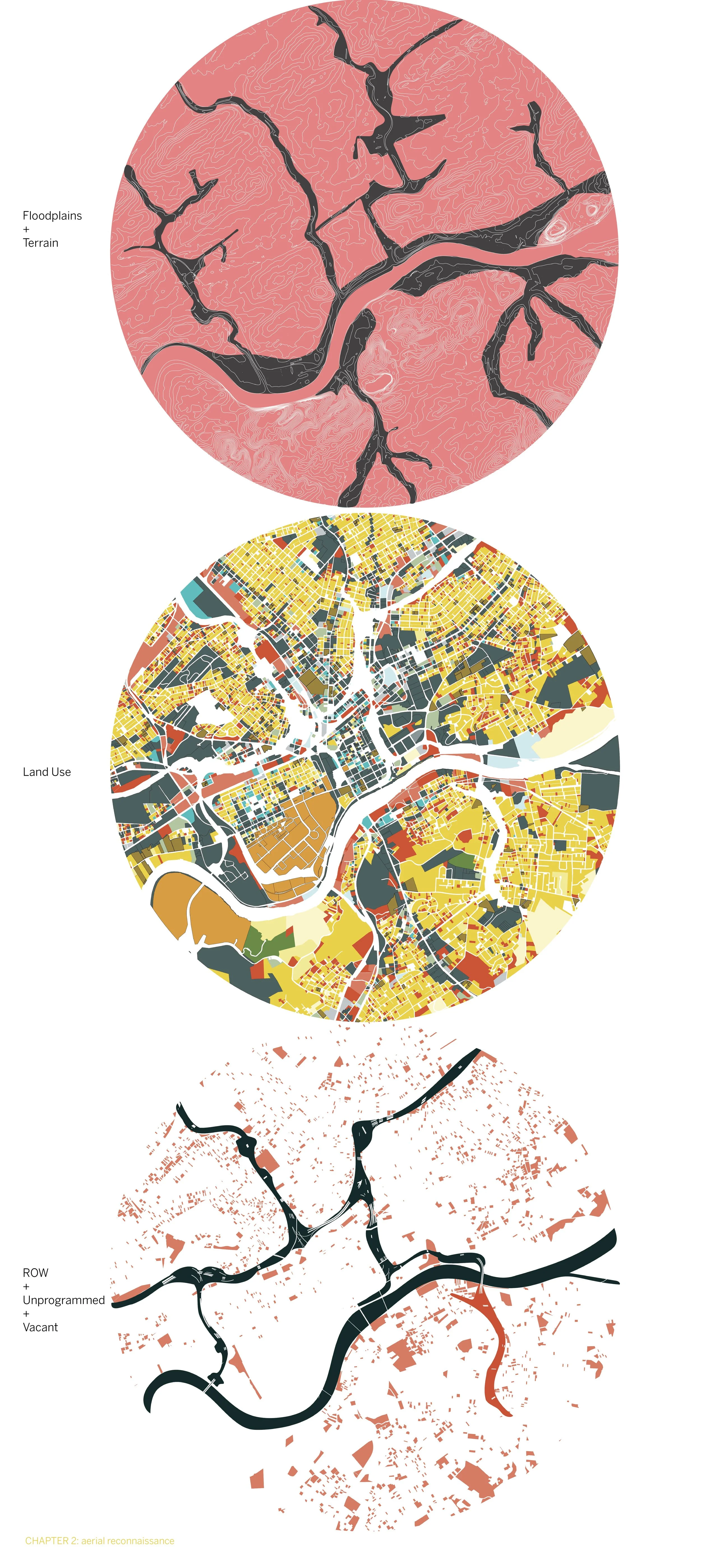
By viewing Knoxville's topography, existing land use, and unclassified/EOTW land together, it becomes obvious how much liminal space around transportation infrastructure remains undeveloped.
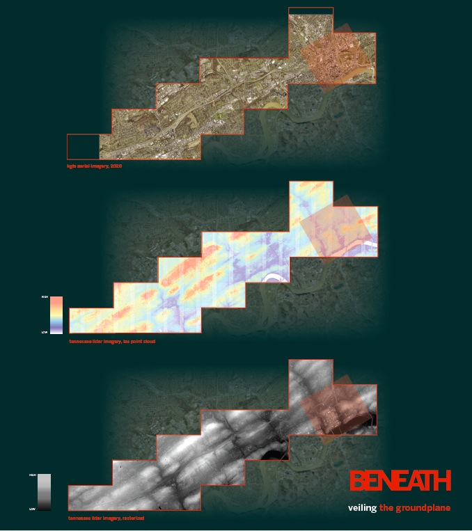
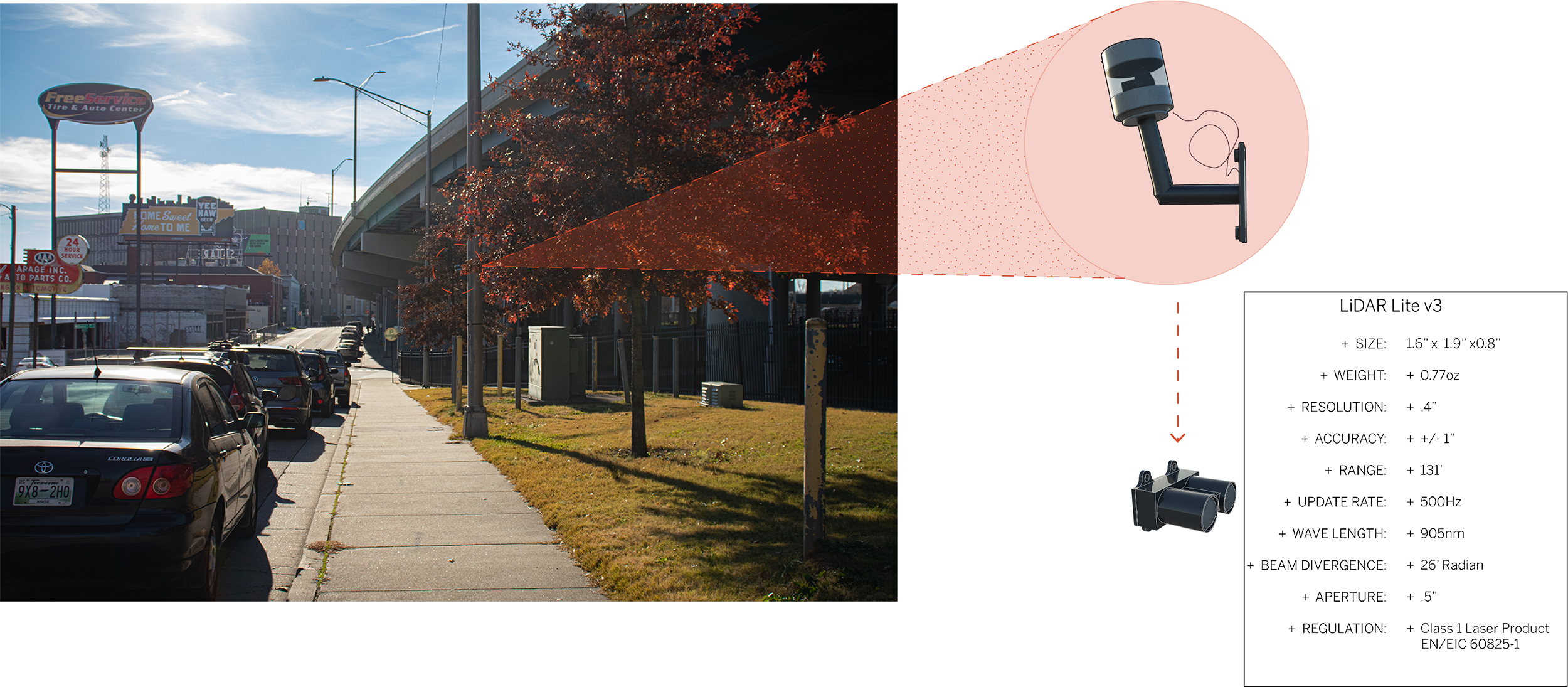
Modern mapping technology uses pulsed light to take detailed elevation readings from the sky, providing a deeper understanding of the city. Through the variations in shade, one can get a better sense of terrain, as seen in this study of I-40.
A closer look shows the connection between lighter shading and the elevated portions of the interstate. Yet the secret world beneath still remains hidden.
Is there a way to use the same technology to capture those hidden spaces?
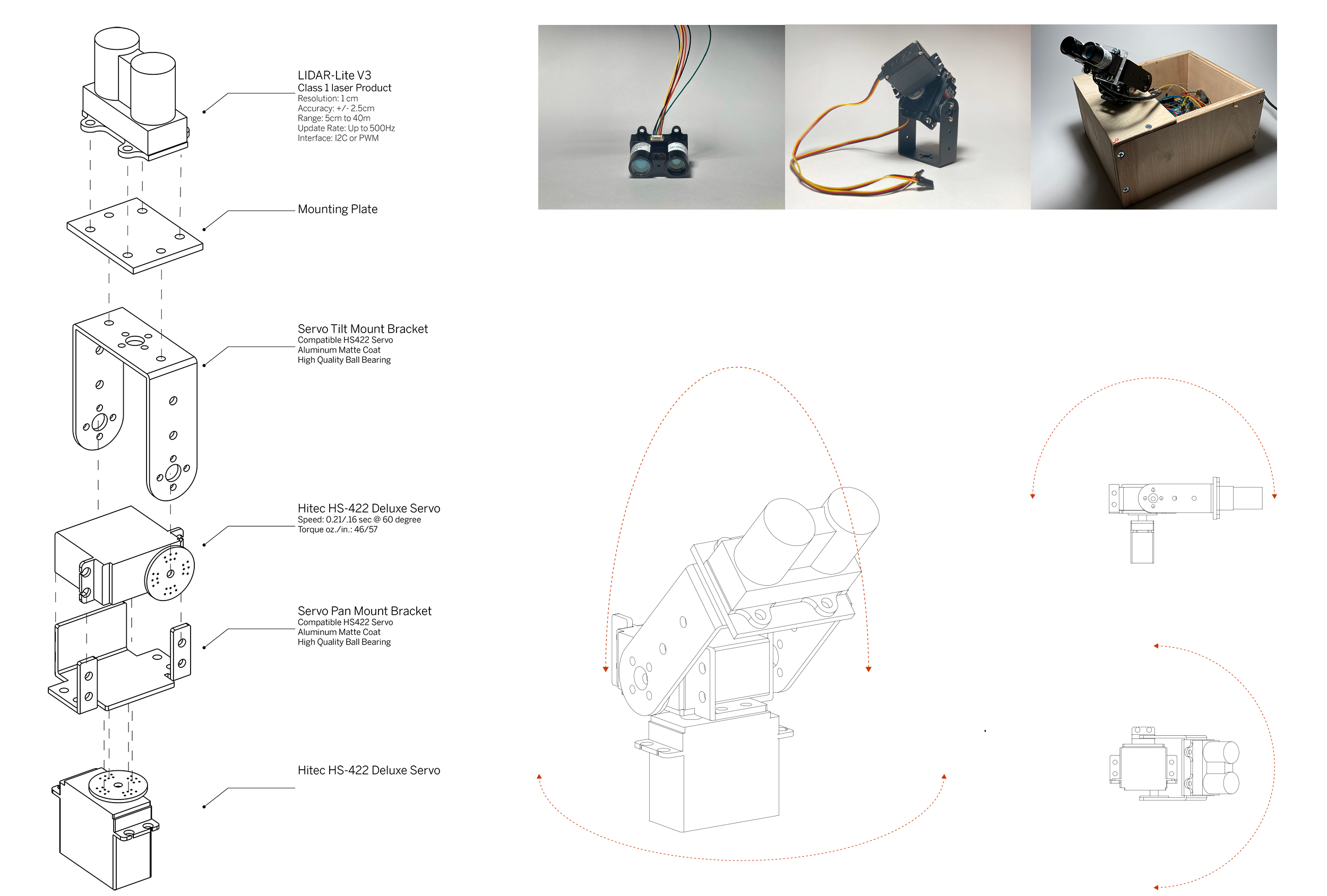
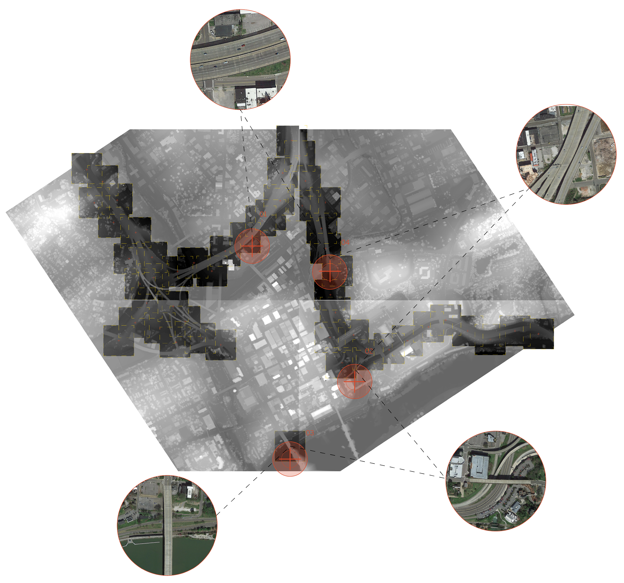
Circumventing the prohibitive barrier established by expensive 3D mapping tech, open-source robotics code and a $100 LiDAR sensor open the door to a new world of 3D mapping and digital imagery. All at the hands of the individual user.
Guerrilla scanning in strategically-selected, hidden sites could repurpose an instrument of the state toward the creation of a sub-verse: a world devoid of materiality, socio-cultural context, and environment.
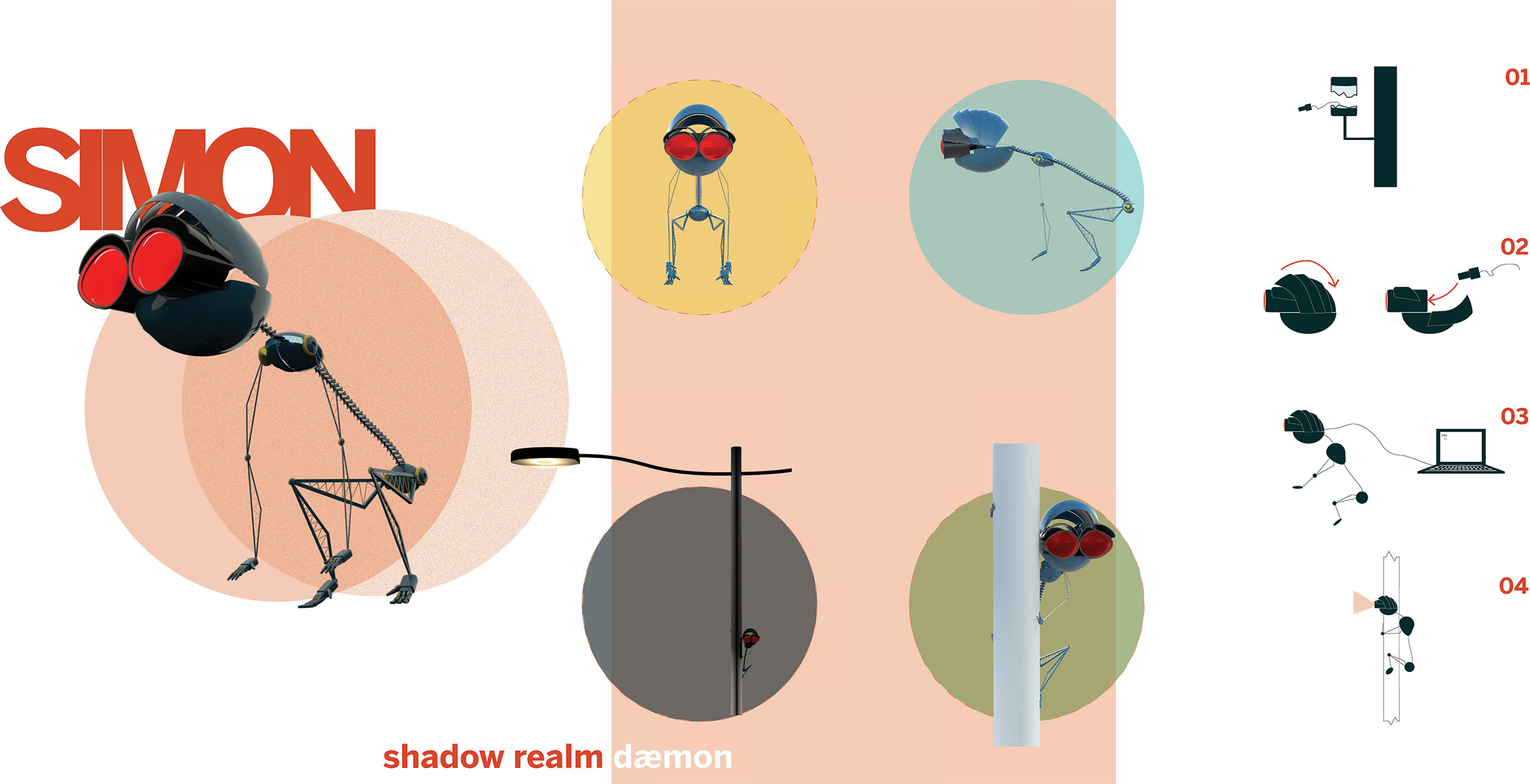
With the help of Simon, your very own semi-autonomous laser-scanning-daemon, you too can explore between the cracks of the urban fabric.
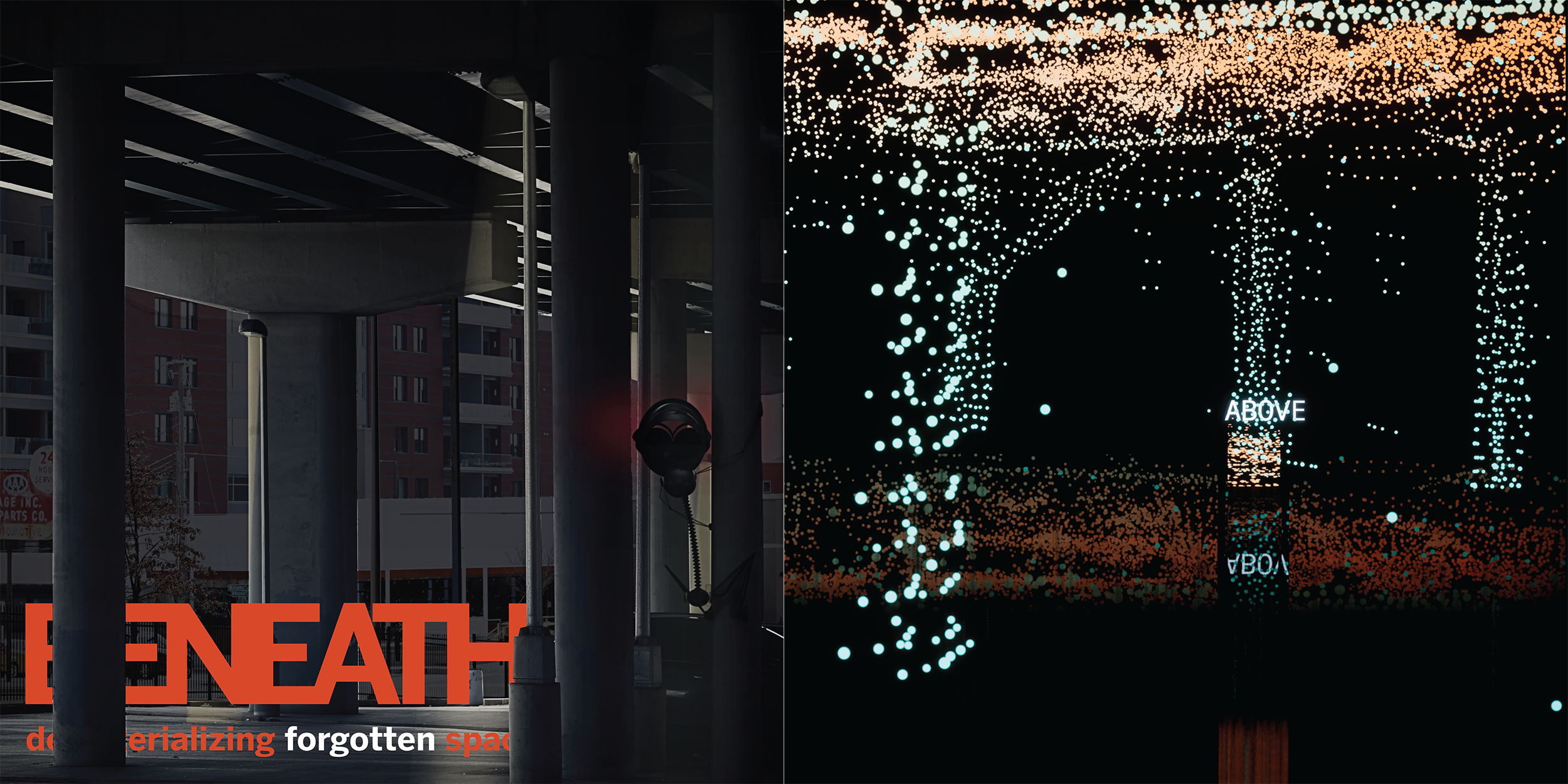
In this world of dots and colors, the edges between cartographic certainty and digital ambiguity begin to blur…
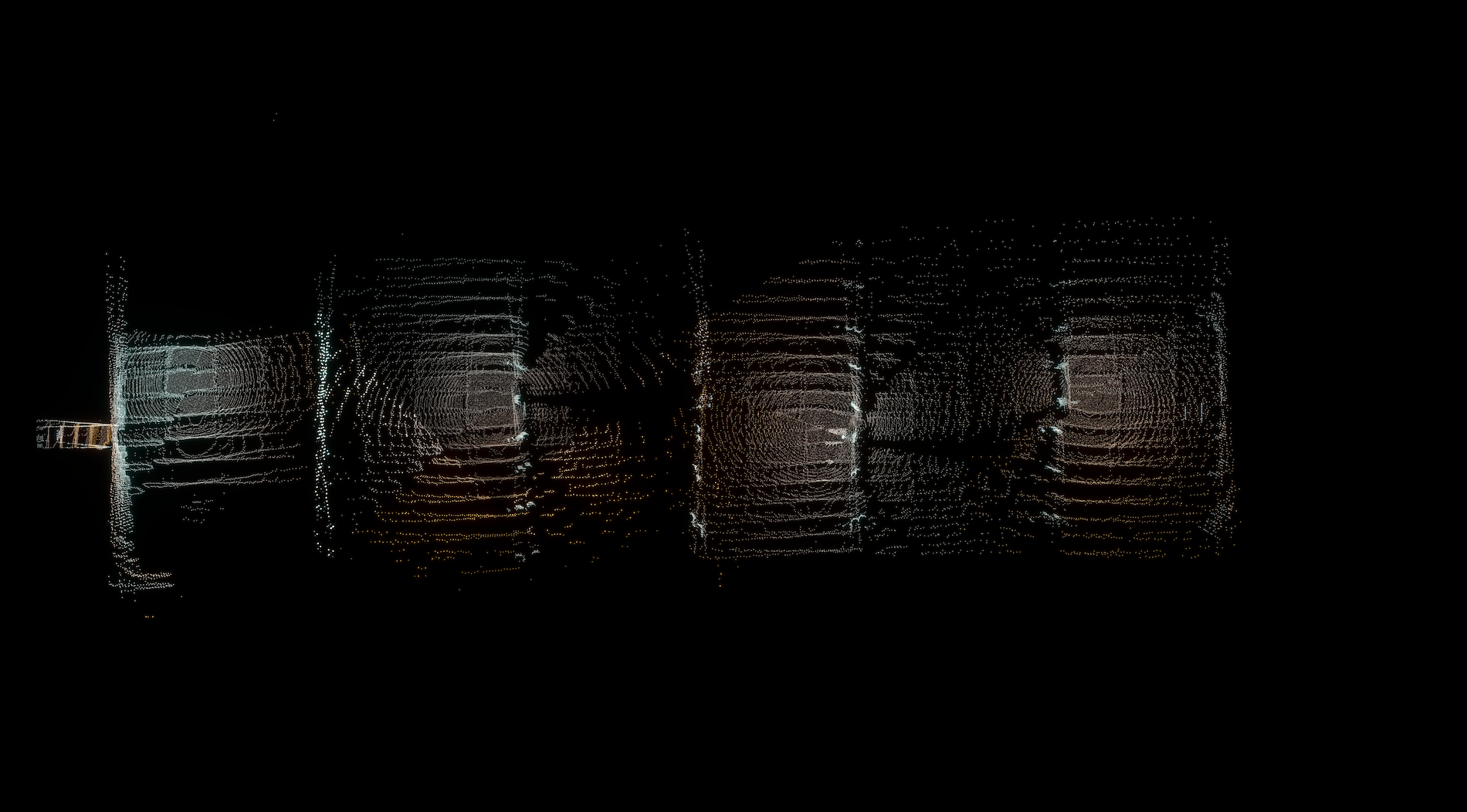
Henley Street Bridge, Top
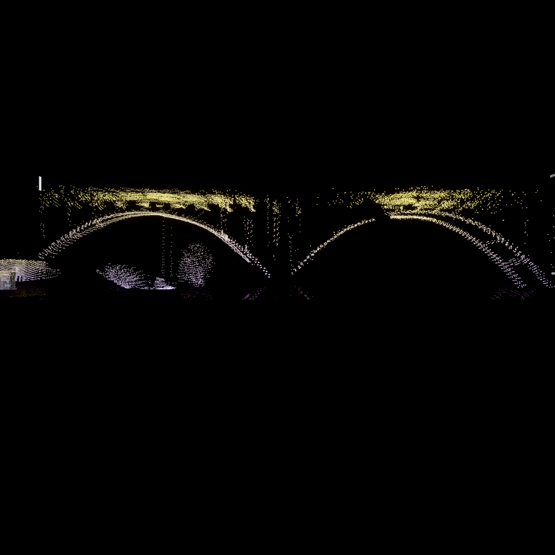
Henley Street Bridge, Elevation
Henley Street Bridge, Immersed
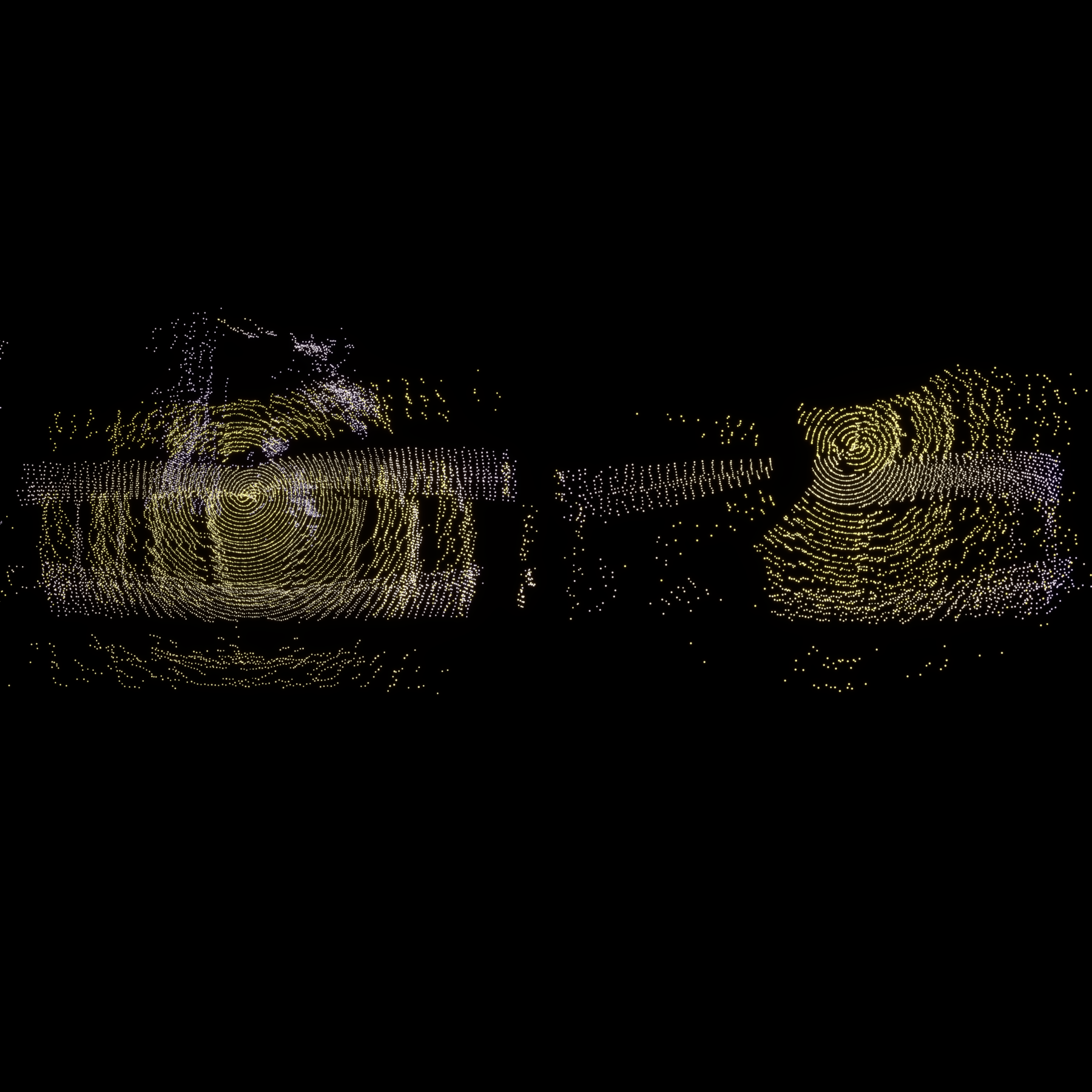
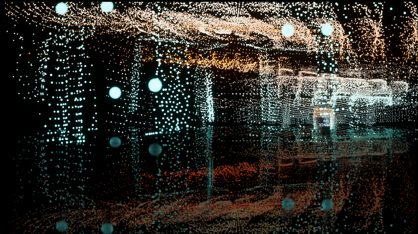
Hill Ave Viaduct, Top
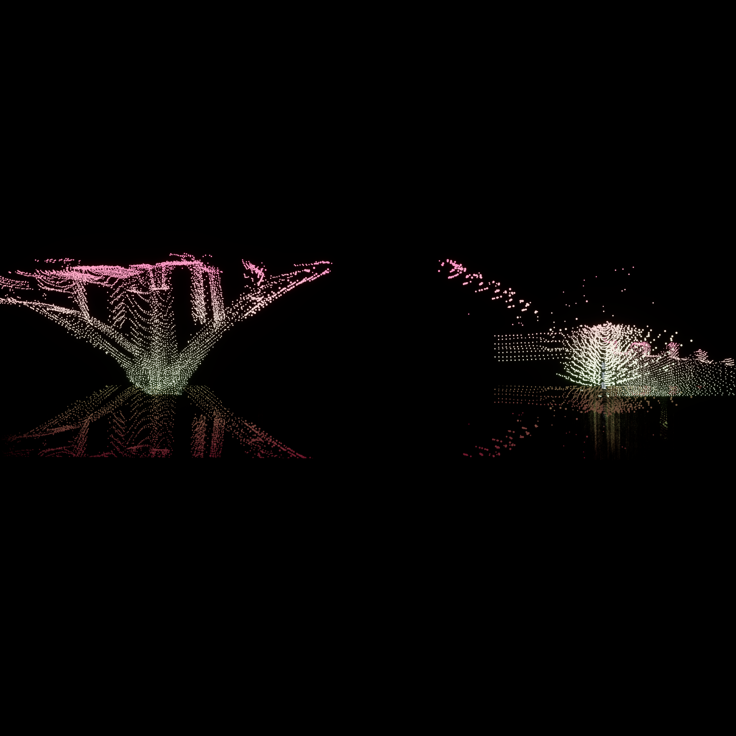
Hill Ave Viaduct, Elevation
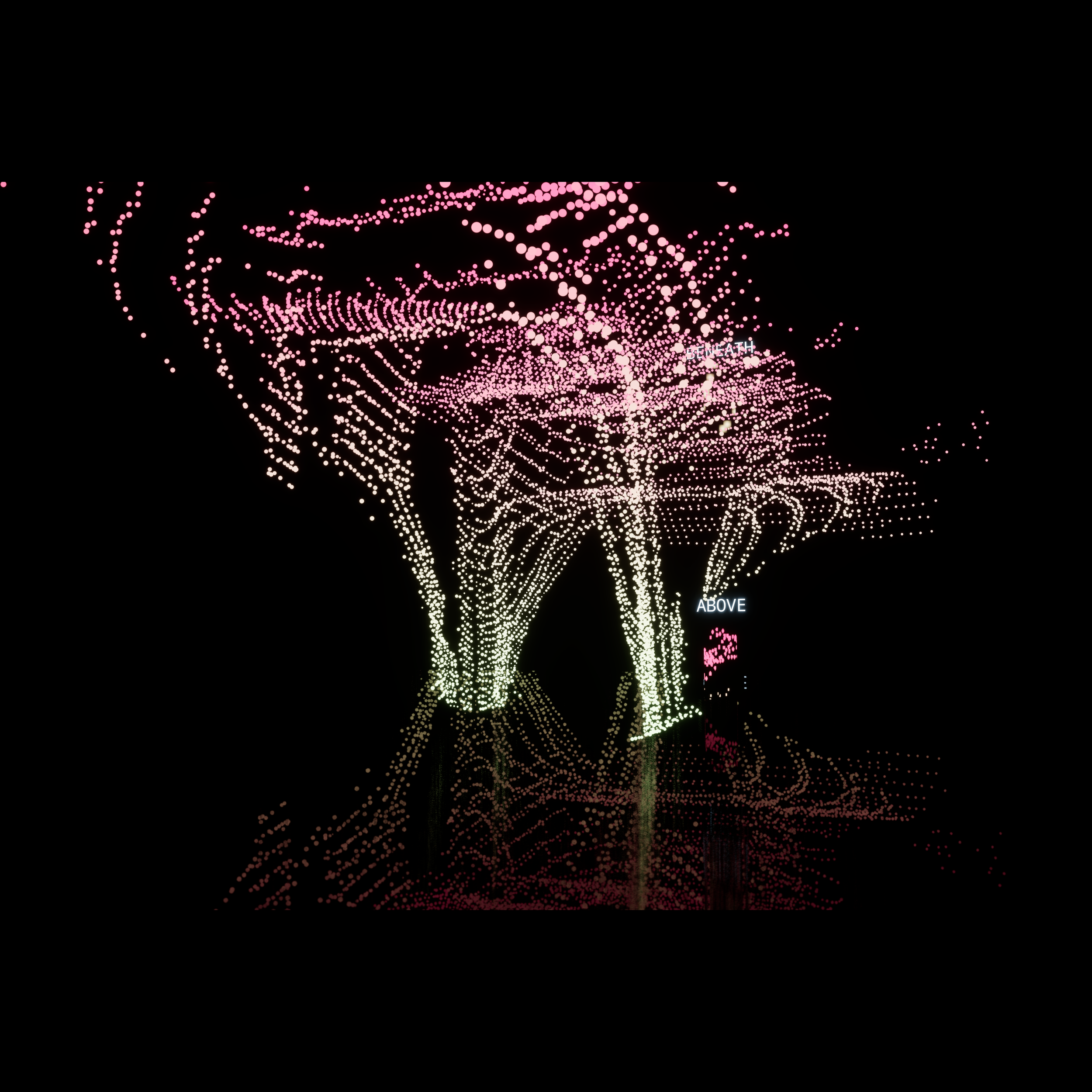
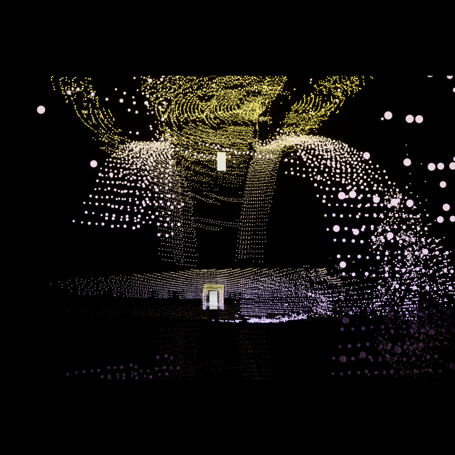
Hill Ave Viaduct, Immersed
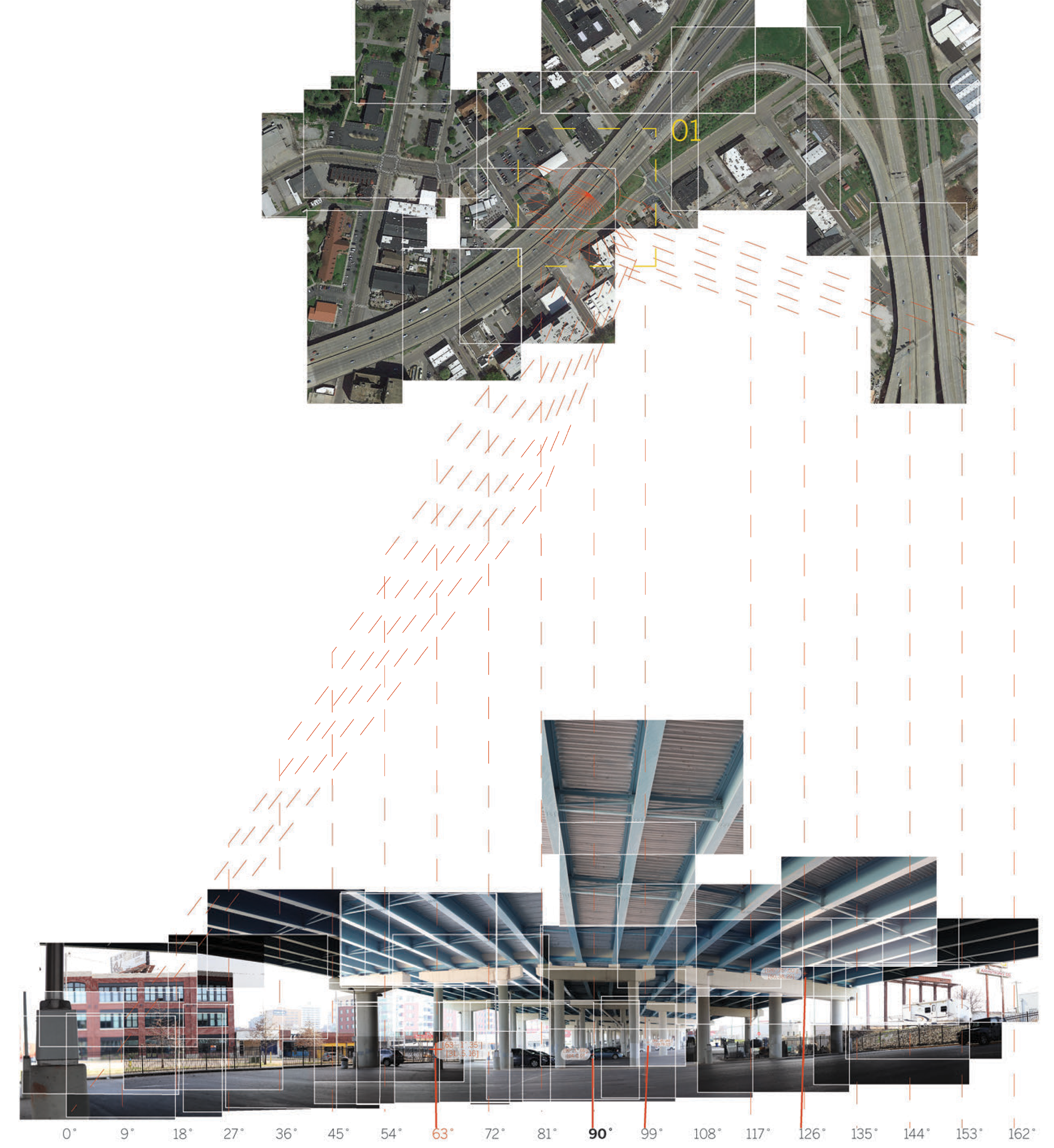
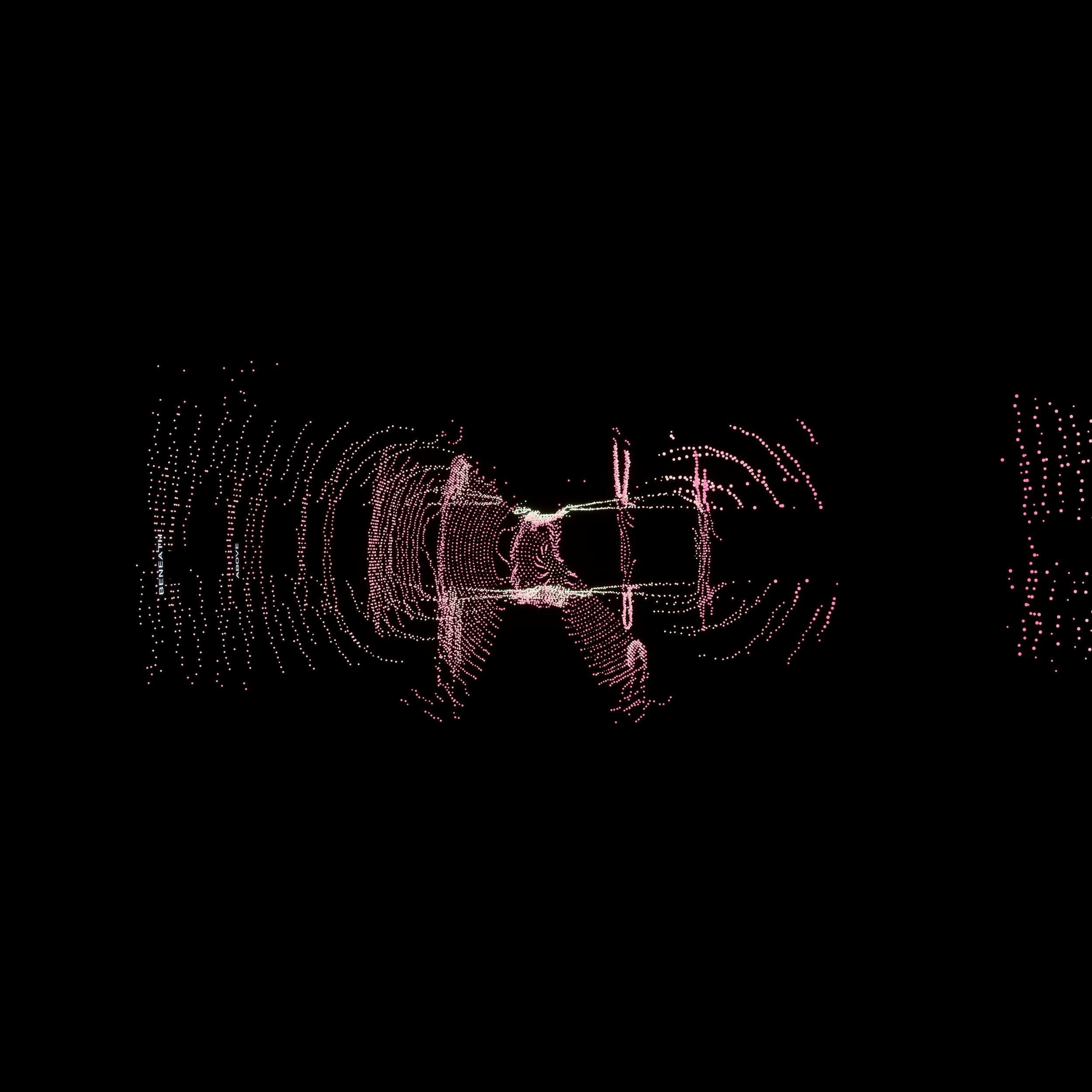
I-40, Top
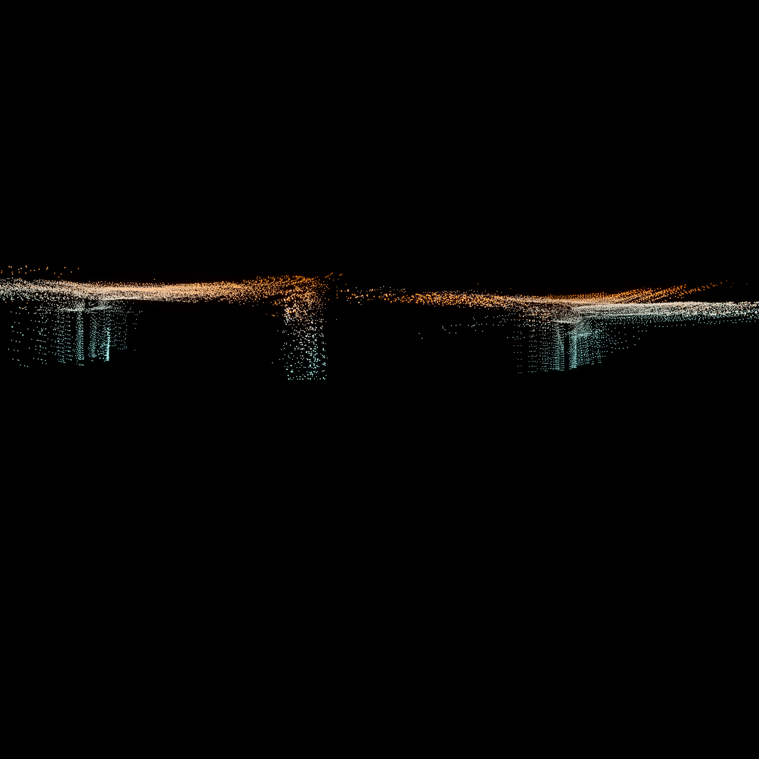
I-40 Elevation
I-40, Immersed